A border that moved
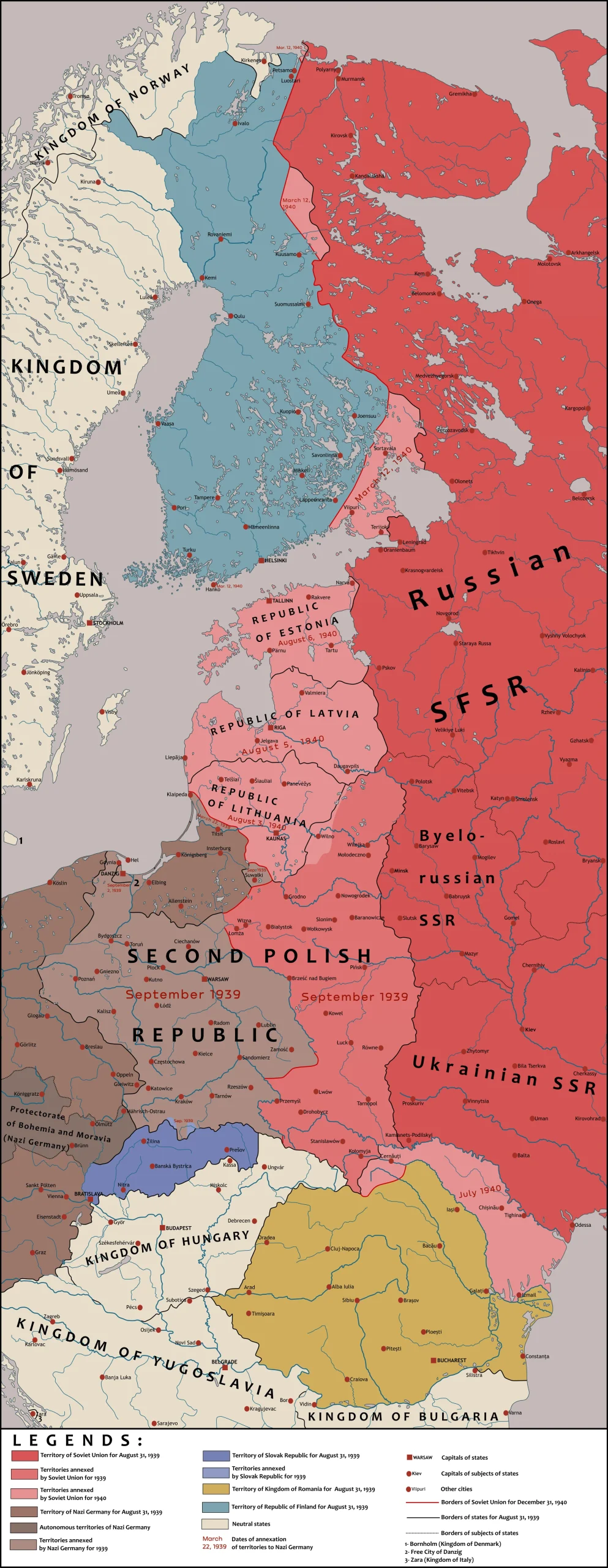
In August 1939 the Soviet Union and Germany signed the Molotov-Ribbentrop Pact, a non-aggression treaty with a secret protocol that divided eastern Europe into spheres of influence. Germany invaded Poland from the west on 1 September, and the Red Army moved in from the east on 17 September. In 1940 the Soviet Union took over the Baltic states and Bessarabia as well. The result was a western frontier that lay hundreds of kilometres further west than the one the Soviet Union had had a year earlier, and it now ran directly alongside German-controlled territory for much of its length.
For Soviet planners this was both an opportunity and a problem. The extra territory gave the country depth, but the new border was long, about 4,500 kilometres by one count, and it ran through country with few prepared defences. The defences the Soviet Union did have were in the wrong place.
The line that was left behind
Since the 1920s and 1930s the Soviet Union had built a chain of fortified districts along its old western border, known as the Stalin Line. It was not a continuous wall. It was a network of concrete bunkers and gun emplacements, similar to the French Maginot Line but less elaborate, meant to channel an invader along certain corridors. After the occupation of eastern Poland the old line lay far behind the new frontier, and the Soviet Union decided to abandon it. Its guns were removed, and many of them were put into storage while new construction began further west. Some Soviet generals argued for keeping both lines, so that the country would have defence in depth, but that conflicted with the military doctrine of the time, which put the emphasis on fighting any invader on his own ground.
The result was a gap. By 1941 the old line was largely abandoned and in disrepair, and the new one was unfinished. When Germany attacked, neither line stopped the invasion, although some parts of the old line were manned in time and contributed to the defence.
An informal name
A new set of fortified regions was started along the new border in 1940. It would later be called the Molotov Line, after Vyacheslav Molotov, the Soviet foreign minister who signed the pact. The name is a modern one. It was not the official label at the time, and it came into common use only much later, helped by the writer Viktor Suvorov, who used it in his book Icebreaker. Suvorov argued that Stalin was preparing an attack on Germany, not a defence against one, and most historians dispute that thesis. The name stuck anyway, but it is a good reminder to treat claims about the line carefully, since a good deal of what is written about it comes from people with an argument to make.
The Soviet term was simpler and more precise. Each of the fortified regions was an ukreplennyi raion, abbreviated UR, which translates as a fortified region or district. When historians and Polish local guides talk about “the Przemyśl UR” or “the Rawa Ruska UR”, they are using the Soviet label.
How it was meant to work
The line ran from the Baltic Sea to the Carpathian Mountains and was divided into 13 fortified regions. Each region covered roughly 45 to 120 kilometres of border. Within each region the concrete bunkers were grouped into “centres of resistance”, which were meant to support each other with overlapping fields of fire, and a dedicated military unit was assigned permanently to each region so that it would be manned from the first hour of a war.
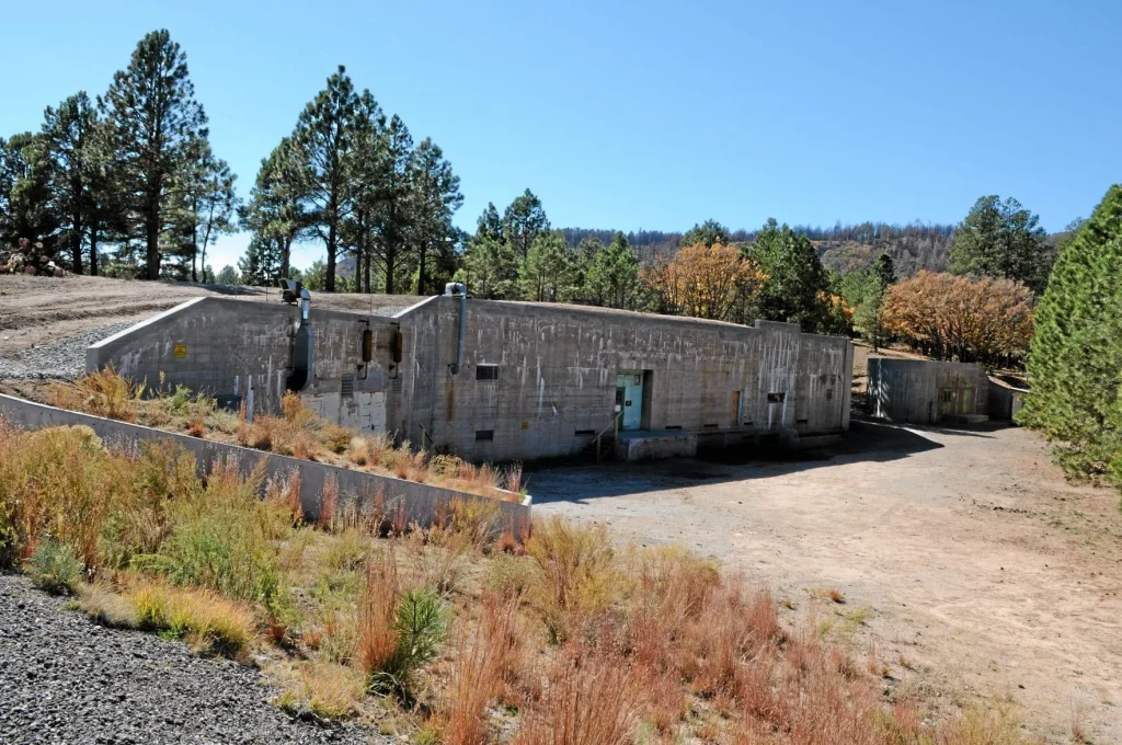
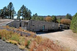
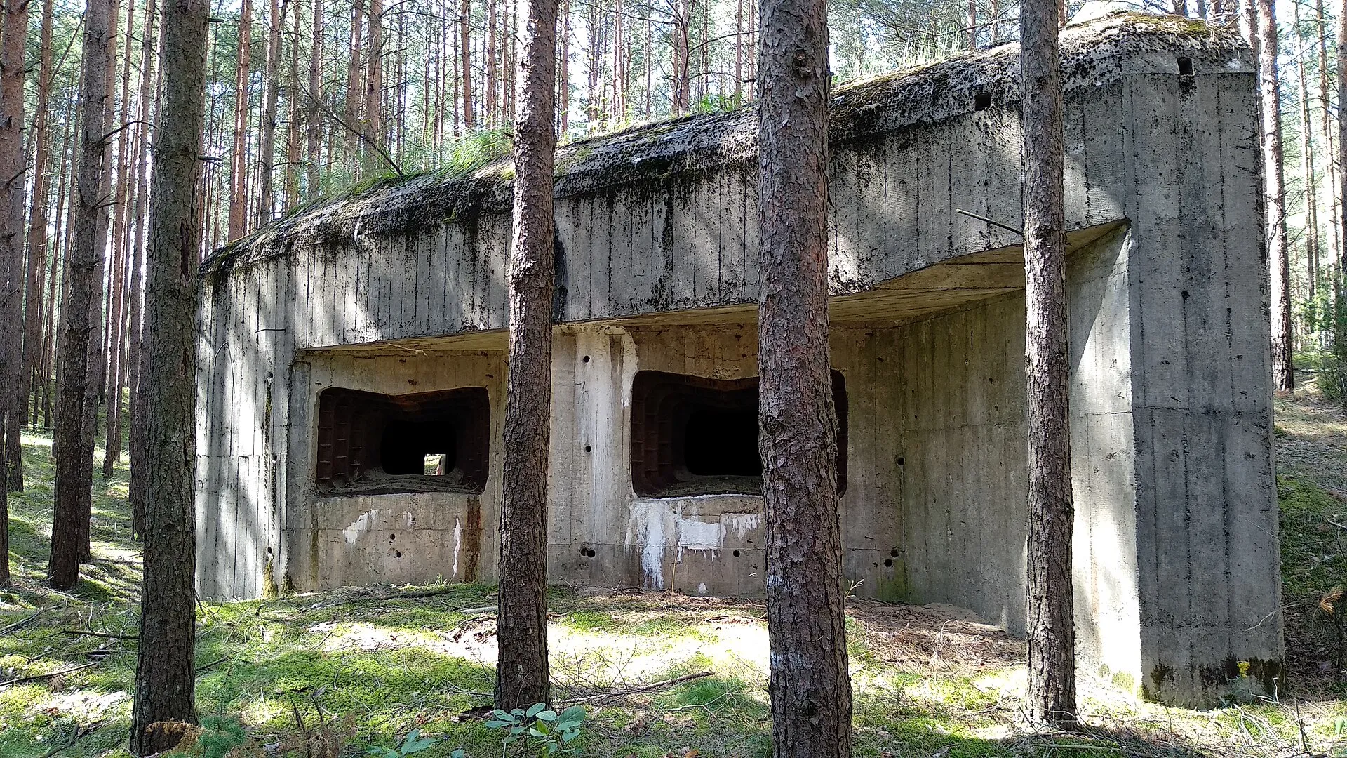
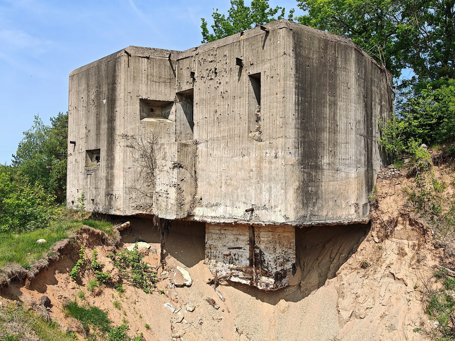
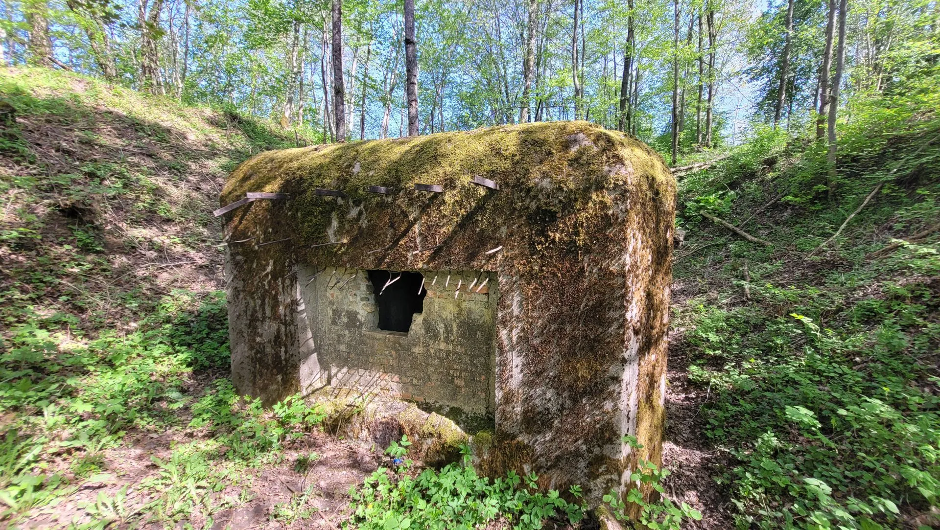
The bunkers themselves were reinforced concrete structures, mostly below ground and covered with earth, with armoured doors. Most had two levels and some had three. The lower floors held food stores, a weapons store, rest quarters and toilets, and the better-equipped bunkers had ventilation, a generator, electric light, running water, sewage and communications. The armament varied. Machine guns were the most common, followed by anti-tank guns, and a few bunkers carried artillery. Anti-tank ditches were dug around them, and a typical section had outposts, tank traps and barbed wire in front, followed by centres of resistance with up to five strongpoints in a chessboard pattern, each two to three kilometres wide.
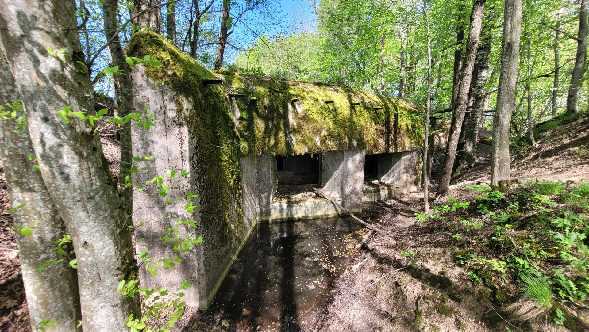
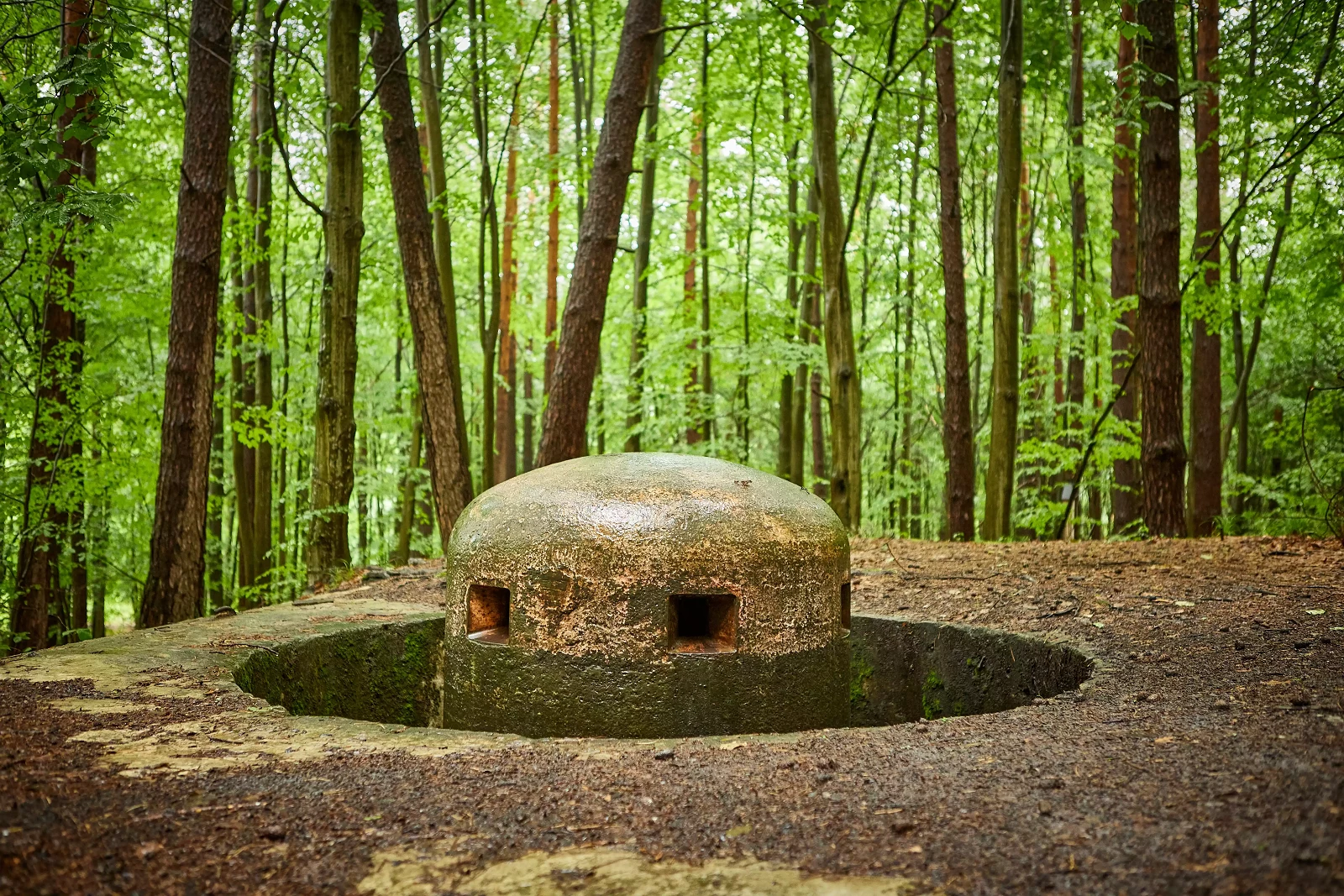
The terminology the Polish guides use for the bunkers at Przemyśl gives a flavour of the design. A bunker built for “side fire” covered the flank of a position, a bunker for “head fire” faced the enemy directly, and some of the larger ones had several embrasures, which are the openings through which the weapons fire, and a small combat and observation dome on top. The point of the arrangement was that attackers advancing on one bunker would be fired on from its neighbours.
The Soviet general credited with designing the system is Dmitry Karbyshev, a military engineer and professor at the General Staff Academy. Some sources attach his name to the Stalin Line as well, and the details of his role are not well documented in the sources I could read. His own story is a grim one. He was captured by the Germans in August 1941, and he died on 18 February 1945 in the Mauthausen concentration camp. In 1946 he was posthumously made a Hero of the Soviet Union.
The thirteen regions
The regions followed the border from north to south. They began in Lithuania with Telšiai, Šiauliai, Kaunas and Alytus, and continued through Grodno, Osowiec, Zambrów and Brest in what is now Belarus and Poland. The southern group consisted of Kovel, Volodymyr, Kamyanka-Buzka, Rawa Ruska and Przemyśl, in what is now western Ukraine and south-eastern Poland. Przemyśl was the southernmost, centred on the city of that name, and it stretched from the Bieszczady Mountains in the south to Sieniawa in the north. Its main task was to defend the bridges and fords over the San river.
The table below gives the figures listed for some of the regions as of 22 June 1941. The numbers come from one published list, and as the next section explains, other sources give different totals, so treat them as an indication of scale and of how uneven the work was.
| Region | Border length | Bunkers built | Bunkers under construction |
|---|---|---|---|
| Telšiai (Lithuania) | 75 km | 23 | 366 |
| Šiauliai (Lithuania) | 90 km | 27 | 403 |
| Kaunas (Lithuania) | 105 km | 31 | 599 |
| Alytus (Lithuania) | 57 km | 20 | 273 |
| Grodno | 80 km | 98 | 606 |
| Brest | 120 km | 128 | 380 |
| Volodymyr | 60 km | 97 | 141 |
| Rawa Ruska | 90 km | 95 | 306 |
| Przemyśl | 120 km | 99 | 186 |
The pattern is clear even if the totals are not. In the north, the Lithuanian regions had a few dozen finished bunkers each against hundreds still being built. The work was further advanced in the south, where the regions were closer to completion. That may help explain why the southern sectors put up the stiffest resistance.
Building it in a hurry
The scale of the effort was enormous. According to a tourism page from the Siemiatycze area in Poland, work began in the summer of 1940, and by the spring of 1941 about 140,000 soldiers and nearly 18,000 specialists were employed on it, along with thousands of local residents who were forced to help. Equipment and materials were taken from the Stalin Line to supply the new one, and that was the first sign of the difficulty. The more guns were sent west, the fewer there were behind, and the new bunkers needed weapons as well as concrete.
Speed brought its own problems. A Lithuanian military heritage publication describes the Lithuanian bunkers as hastily built, and says that work was started on 101 concrete bunkers in Lithuania but none had been finished and fully equipped by the time war broke out. In places the work was of poor quality. The Soviet planners were trying to build a deep and complex defensive belt on a border that had existed for only a few months, in an area where they had no local knowledge, few roads and a population that was often unfriendly.
Counting the bunkers
Almost every figure attached to the Molotov Line comes in more than one version, and it helps to know why. One description counts about 2,500 concrete bunkers along the border, of which over 1,000 were fully equipped. The Przemyśl tourist office also says more than 2,500 reinforced concrete bunkers. The Siemiatycze tourism page gives a different breakdown: about 1,900 shelters finished by June 1941, of which 542 were for machine guns, 460 for anti-tank weapons, 68 for fortress artillery and 43 for command posts, with roughly 800 still under construction. Another account says that over 2,500 fortified points existed but most had only machine guns. The Lithuanian publication, meanwhile, says none of the Lithuanian bunkers was complete.
Some of the disagreement is about definitions. A bunker that has its concrete but no weapon, a bunker that has weapons but no ventilation, and a bunker that is still a hole in the ground are all “bunkers” in some counts and not in others. Some is about dates, since construction was still going on every day. Some is about whether the older fortifications along the border, such as the Brest Fortress, are included. The statement that most often appears is that about a quarter of the planned positions were complete when Germany invaded. That figure is a rough one, but it fits the broad picture, which is a line that was largely built in places and largely unfinished in others.
A quarrel in the Soviet command
The unfinished state of the line was not only a matter of time and materials. It also reflected a disagreement about how the frontier should be defended. One account says that Georgy Zhukov, who became chief of the General Staff in January 1941 after war games showed flaws in a forward defence, opposed moving the old fortifications and redirected artillery that had been meant for the new regions to the rear. He favoured an active defence in depth, and accepted risk in the exposed Białystok salient, where Soviet forces projected westward into German-held territory. The same account says that artillery, engineers and pontoon units were withdrawn from the border under the pretext of exercises and sent to reinforce the second echelon, and that some of the border fortified regions were partly dismantled and reassembled in the salient area.
I could only find this in one source, and it is part of the larger argument about how prepared the Soviet Union was, so it is best read as a claim to be tested. What is not disputed is the result. In June 1941 a number of the regions had the shell of a defensive system and not much of the weapons to put inside it.
Unfinished in June 1941
The key fact about the Molotov Line is that it was not complete when it was needed. By the time Germany attacked on 22 June 1941 only about a quarter of the planned positions were finished, and a great many bunkers were still holes in the ground. Armament was a larger problem than concrete. Some accounts say the artillery meant for the fortified regions had been pulled back, and that the troops who were supposed to man the bunkers were stationed some distance away, where they could not reach them in time. These accounts are not always sourced.
The Brest Fortress is sometimes described as part of the line. It was not. It was an older fortification that happened to stand on the same stretch of border. It is a separate story, because it held out for much longer and became a symbol of the first days of the war.
The first days of Barbarossa
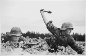
When Operation Barbarossa began, the German army attacked along the whole front. In the north and centre the line was a negligible obstacle. Many positions were empty or simply bypassed, and the Lithuanian bunkers were reportedly neutralised quickly with grenades or with burning fuel poured into their unprotected periscope shafts. One account describes the German 6th Panzer Division leaving the Tilsit area on 22 June, crossing Lithuania and Latvia, breaking through the Stalin Line, crossing the Dvina and reaching the Luga river within about three weeks. The old line and the new one were behind it before the Soviet command had understood what had happened.
Further south, where the regions were more advanced, the picture was different. The four southernmost regions, partly completed, slowed the Wehrmacht for a few days. A Polish site near the Podlaskie town of Kolno records that the bunkers at Stary Gromadzyn were used in fighting against the Germans from 22 to 25 June 1941, and that the Germans used the fortifications later.
A better-documented example comes from the Rawa Ruska region near Lviv. According to a short account, the 102nd Rifle Regiment of the 41st Rifle Division held its fortified line against the German assault on 22 June 1941, and on the morning of 23 June counterattacked, driving the Germans back and advancing about three kilometres into the German-occupied General Government before returning to its positions that evening. The division held the line until 27 June, when it had to withdraw to avoid being cut off. The account gives no sources or casualty figures, and it calls the action a local success that could not change the overall disaster. A Polish doctoral thesis from the University of Rzeszów, by Tomasz Zając and dated 2018, studies the fighting around the Przemyśl fortified region and Sanok in late June and early July 1941.
The wider story was one of disaster. Local successes could not change the overall situation, as the armies behind the line were destroyed or driven back, and the wall in front of them did little to stop that. One assessment says the incomplete fortifications were among the strongest defences of the 1930s, and still proved no match for the Wehrmacht.
Offence or defence?
The Molotov Line sits at the centre of a debate that is older than the name. One reading is that it was a defensive barrier, started late and handicapped by the haste of the work, by shortages, and by a Soviet leadership that did not expect an attack in 1941. The other, which goes back to Suvorov, is that the Soviet Union was preparing to strike first, and that moving men and equipment forward and away from fortifications was part of that plan. Most historians reject the second view, although the questions it raises about Soviet deployments in the spring of 1941 are real ones.
The bunkers cannot settle the matter. What they show is that Soviet planners were building a defensive belt in 1940 and 1941, spending enormous labour on it, and that it was not ready when the invasion came. Whether that was a failure of preparation or a result of a different strategy is a question the concrete leaves open.
After 1941
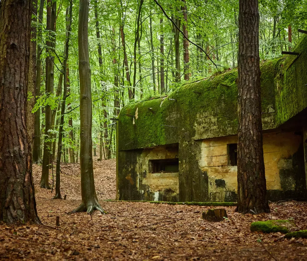
The line did not disappear when the front moved east. Some of the bunkers were used by the Germans, and the Red Army passed over the same ground when it advanced west in 1944. After the war the fortifications were not maintained, partly because they were so widely dispersed. In Western Europe many similar structures were demolished, but along the old Soviet frontier much of the line survived because it was ignored. In the countries that had been on the Soviet side of the pact, the bunkers were left in fields and forests.
What is left
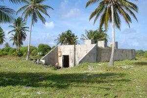
Ruins of the line survive in Lithuania, Poland, Belarus and Ukraine, and many are well preserved. In Lithuania the line ran about 328 kilometres from Palanga to Kalvarija, and unfinished bunkers still stand in fields, such as the one near Endriejavos. In Poland about 250 objects from the two fortified regions in the Podkarpackie province are reported to survive, with over 200 in the Przemyśl region and around 120 in and around the city of Przemyśl itself. Further north, a 4.2-kilometre walking trail called “Molotov’s canines” runs through bunkers in the Siemiatycze area of Podlaskie.
Przemyśl is the easiest place to get a sense of it. The city’s tourist office lists 22 sites, from a ruined double-embrasure bunker on Sanocka Street to bunkers in the grounds of the old Austro-Hungarian forts that ring the city. Others stand beside the riverside embankments, behind a supermarket, in a back garden, under a ring-road bridge and on the grounds of a sewage treatment plant. A local writer who walked the route notes that the bunker on Sanocka Street is in the best condition and is painted in its original camouflage scheme, while the one on Szańcowa Street is extremely overgrown and hard to reach, and that some are inside industrial premises and not open to the public.
The result is a landscape in which a visitor can walk down an ordinary street and find a Soviet bunker behind a fence, in a place where nobody expects it. Many are in poor condition and some have been filled in, built over or reused. Several stretches lie close to the modern borders between Poland and Belarus or Ukraine, and between Lithuania and Belarus or Russia, where access may be restricted for security reasons.
Visiting
Przemyśl is the easiest place to see the line. The tourist office has a list of sites with street names, and the Siemiatycze trail offers a marked walk with a downloadable GPS track. Treat the bunkers as what they are: old military structures, often damp, dark and unsafe, and sometimes on private land. Do not enter a bunker unless it is clearly open to the public, and stay out of anything fenced or sealed. If you go to the stretches near the borders with Belarus or Ukraine, check which areas are restricted first.
Conclusion
The Molotov Line is a story about timing as much as concrete. It was started when the Soviet Union’s border moved west, it drew on the guns and materials of an older line that had just been abandoned, and it was never finished before Germany struck. Where the bunkers were armed and manned, as in some of the southern sectors, they could delay the attackers for a few days. Where they were not, they were bypassed, and a line that had cost enormous effort did very little.
That gap between the plan and the day of the invasion is why the line is still argued about. Some historians read it as a defensive wall that came too late. Others read the Soviet decisions around it, such as stripping the old line and moving forces forward, as evidence about what Stalin intended. The bunkers do not settle that argument. What they do is stand in forests, fields and city streets across four countries, and they show how close the two armies were when the war began.
Did you know?
- The line was planned as 13 fortified regions from the Baltic Sea to the Carpathians.
- Only about a quarter of the planned positions were finished when Germany invaded.
- The name "Molotov Line" is a later, informal label and not the official Soviet one.
- Przemyśl's tourist office lists 22 bunker sites in and around the city.
- The Brest Fortress is often linked to the line but was an older fortification.
- About 250 structures are reported to survive in Poland's Podkarpackie province.