A runway at the top of an island
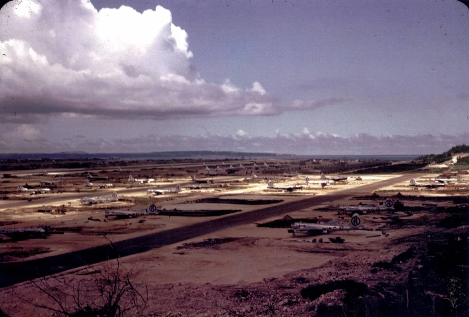
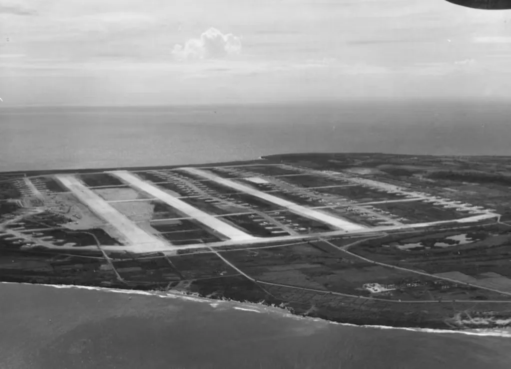
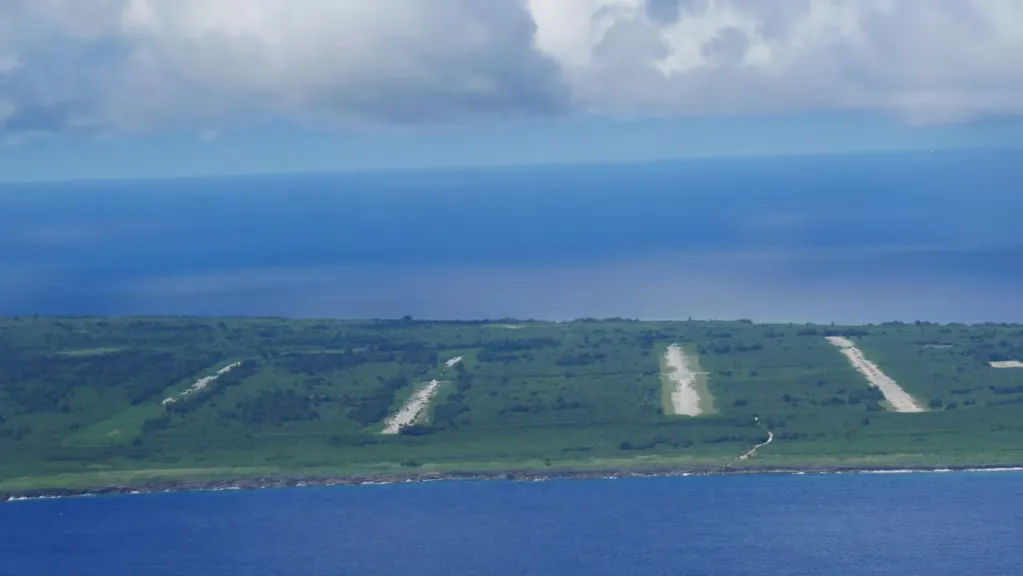
From the air, the northern end of Tinian still looks like something that does not belong there. The island is a small, flat piece of limestone in the Marianas, about 101 square kilometres in all, and its northern plain is crossed by four long straight strips, parallel and evenly spaced, each of them roughly a mile and a half long. Between them run taxiways and aprons, and in the wet season the forest closes in on both edges. This is North Field. In 1945 it was, by the claims made at the time, the largest airfield in the world, and from it the two aircraft that carried the first atomic weapons used in war took off for Japan.
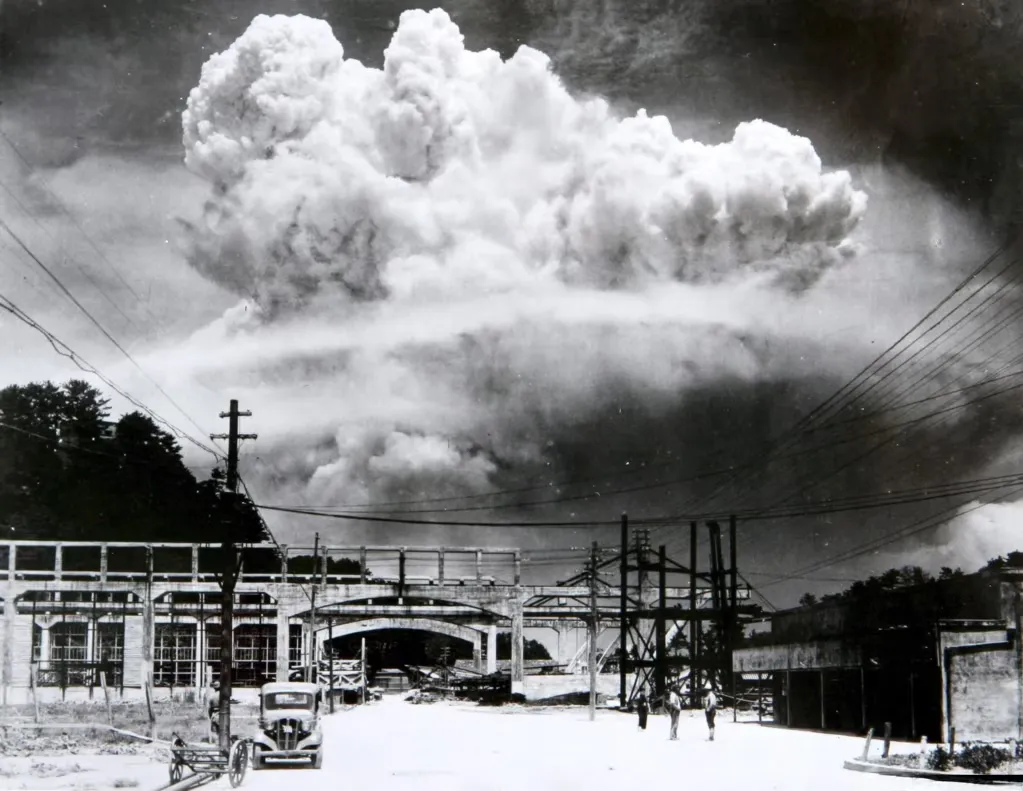
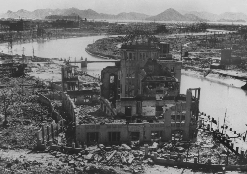
This post is about the place itself: the island it was built on, the people who lived there before, the Marines who took it, the Seabees who made it, the machine it turned into and what is left of it now. The two missions that left from here, to Hiroshima on 6 August 1945 and to Nagasaki on 9 August, are told in our posts on those two bombings and are not retold here. What this post adds is where they began, and why that place was chosen.
An island with a long memory
People have been on Tinian for a very long time. The Marianas were among the first islands of remote Oceania to be settled, by migrants who arrived around 1500 to 1400 BC. Their descendants raised the stone-pillared structures called latte, and the House of Taga site on Tinian is among the most important of them: it had twelve large latte structures, and one is still standing. The Spanish formally took the island in 1669 and ran it as a ranching post to supply passing galleons. Disease and removal were catastrophic. The indigenous population, estimated at about 40,000 when the Spanish arrived, fell below 1,400, and the survivors were moved to Guam in 1720.
Spain sold the Marianas, apart from Guam, to Germany in 1899, which did little with them. Japan took them in 1914 and was formally awarded them in 1918 by the League of Nations. That is when Tinian became a place of sugar. The Japanese built ports, roads and power stations, and planted sugar plantations across the flat land that would later be graded for runways. They brought in settlers from Japan, Okinawa and Korea. By June 1944 about 15,700 Japanese civilians lived on the island, including some 2,700 Koreans, and, in a detail that says a lot about who the island belonged to by then, only about 22 Chamorros. One census figure puts the civilian population at about 18,000 in early 1944, but we treat that as a different date and a different count from the later one rather than a contradiction.
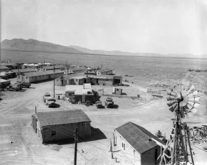
The military arrived with the plantations. Japanese military construction on Tinian began in 1939, using about 1,200 prisoners sent from Japan, and by 1944 the island had three airfields and a fourth under construction. The northern one was called Ushi Point. It was a modest strip, around 4,400 feet long, and it served the Imperial Japanese Navy’s 121st Kokutai, which flew Nakajima reconnaissance aircraft from it. Nobody who built it can have imagined what it would grow into. Ushi Point was one of several airfields on an island chosen for a reason that had nothing to do with sugar: Tinian lies about three and a half miles from Saipan, and its flat cane fields made good airfield country.
Why Tinian
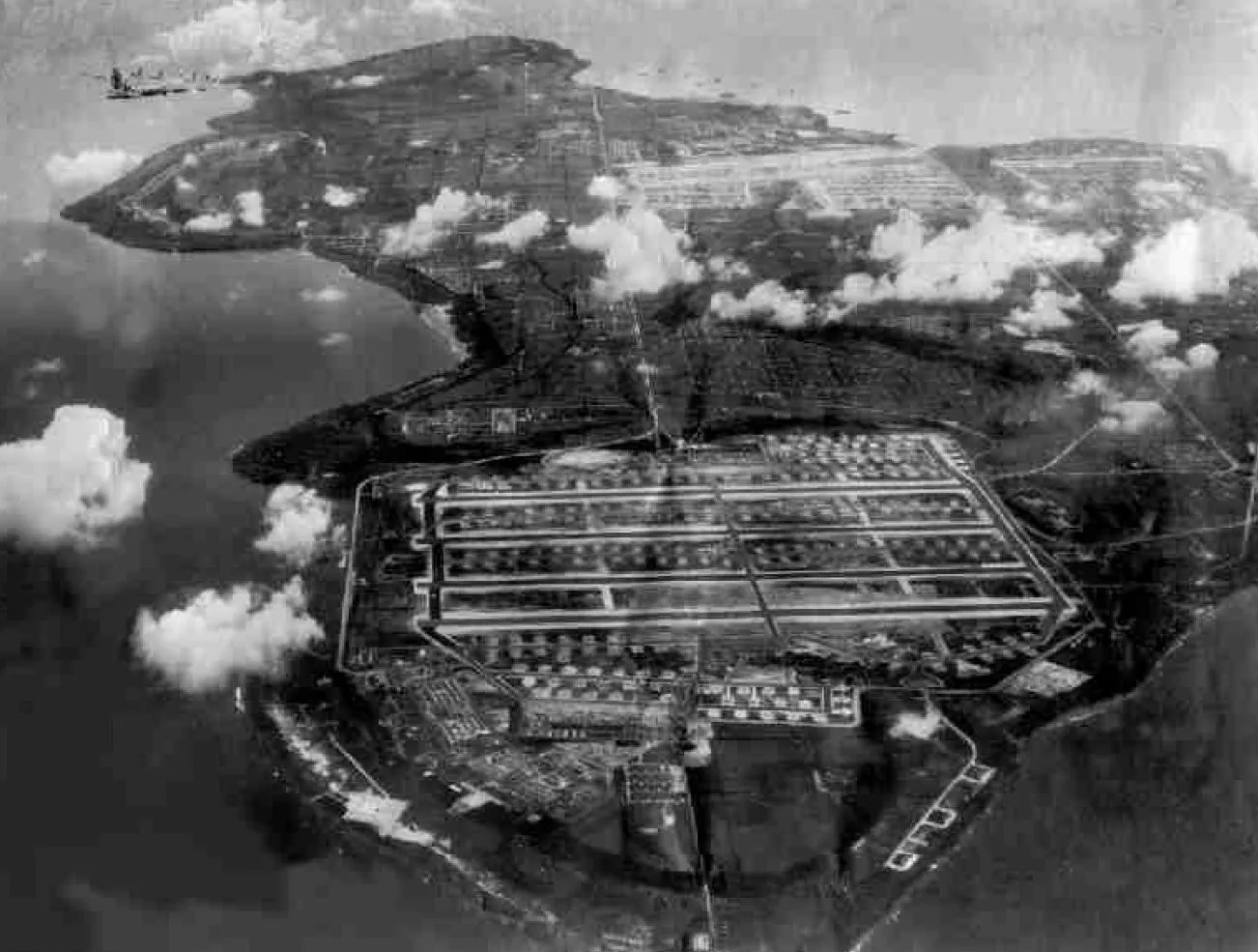
By mid-1944 the Americans were island-hopping towards Japan, and the Marianas were the prize, because the new B-29 Superfortress could reach the Japanese home islands from them. The long-range bomber was a machine that needed long runways, and it needed a lot of flat ground to put them on. Saipan fell first, and Guam was next. Tinian completed the set. The Americans wanted its airfields, and the fact that it was so flat, covered largely in cane, made it the best airfield site of the three.
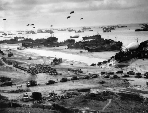
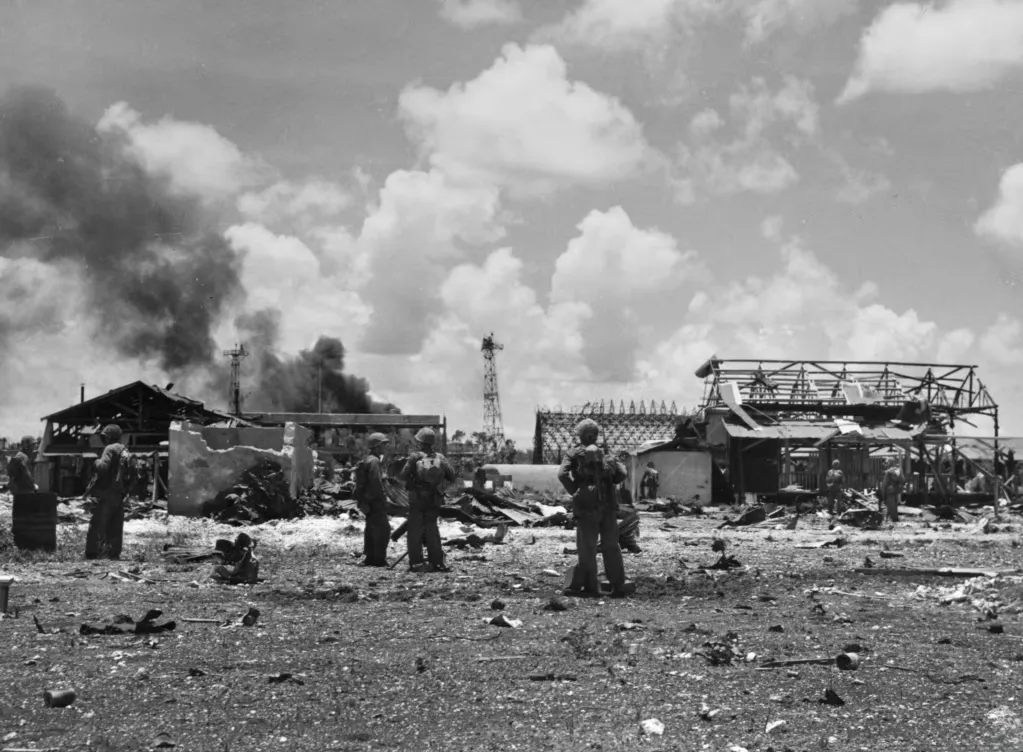
The landing on 24 July 1944 is remembered as one of the most skilful of the Pacific war. The Americans made a feint off Tinian Town, in the southwest, which drew the defenders there, and then put the main force ashore on two tiny beaches in the northwest, called White 1 and White 2, together only about 180 yards wide. Ramps fitted to amphibious tractors let the Marines climb the low cliffs behind the sand. By evening about 15,600 men were ashore, at a cost of 15 killed and 225 wounded. Lieutenant General Holland Smith, the senior Marine commander, later called it the perfect amphibious operation in the Pacific war.
The Japanese counterattacked that night in the open, as their doctrine told them to, and lost heavily: about 1,200 dead by one count, up to 2,000 by another. The Marines took Ushi Point on 26 July, along with several Japanese aircraft found almost intact in a hangar. The rest of the fighting was in the south, on a limestone plateau where the last of the garrison made its stand. The island was declared secure on 1 August. The figures vary by source: roughly 290 to 368 Americans killed ashore, and between about 5,500 and 5,750 Japanese dead, with 404 taken prisoner, out of a garrison of about 8,500 of whom only 313 are recorded as surviving. It was a short, hard battle, and it was the first in which the Americans used napalm, though the results of the 18 sorties were inconclusive.
The civilians suffered as much as the soldiers, and a place post is the right place to say so. About 1,658 had been evacuated before the landing, and an estimated 2,610 died during the battle, some killed by soldiers and others in mass suicides, most notably at the high cliffs between Mapo and Lalo Points. The survivors were gathered into Camp Churo, which held 11,465 people on 16 August 1945: about 9,090 Japanese, a little over 2,300 Koreans and four Chinese. The camp had separate sections, held elections in July 1945 and ran a school and a market. Repatriation was finished by late 1946. The runways that came next were built over a landscape that had been somebody’s home a few weeks earlier.
Forty-five days and nights
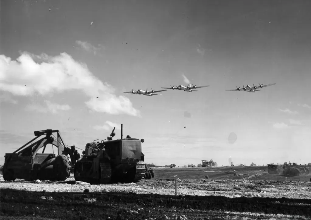
The first Seabees landed with the Marines. Around 1,500 of them came ashore in the first wave in July 1944 and started work before the fighting was over, often under fire. The Ushi Point strip had been almost completely destroyed by naval gunfire and air attack, so they began from very little. The fuller force was the 6th Naval Construction Brigade, which became operational on 3 August 1944 under Captain Paul Halloran. North Field fell to its 30th Regiment, made up of the 67th, 110th and 121st Naval Construction Battalions, and the 121st is the one named in accounts as landing during the assault. West Field, on the other side of the island, was built by a later regiment. By the end there were more than a dozen battalions and about 13,000 Seabees on Tinian.
What they did is hard to picture. In about 45 days and nights they turned the Japanese strip into a field for the world’s heaviest bomber, moving nearly a million cubic yards of earth and coral on the first phase alone, with about 900,000 truck miles driven. One account says the field was ready eleven days ahead of schedule. The whole job eventually moved far more material, estimated at about 11 million cubic yards across the island, a volume that one retelling compares to roughly three Hoover Dams. We treat that comparison with caution because it comes from a single article, but the scale is not in doubt.
The finished North Field had four parallel runways lettered A to D from north to south, which were later joined by two more at West Field. The sources disagree on their length: 8,000 feet in one place, 8,500 in most, and one account says the first three were 6,000. We think 8,500 feet is the best supported figure, since most sources give it, and the 6,000-foot figure may describe the runways before they were extended. The four were roughly 1,600 feet apart, joined by about 11 miles of taxiways, with hardstands for 265 B-29s. The first B-29 landed on 22 December 1944, and the fourth runway was finished on 5 May 1945.
The Seabees also named things, and the names are one of the best-known features of the island. Someone noticed that Tinian, long and narrow, looked like Manhattan on a map, and the road grid was laid out accordingly. The main north-south road is still called Broadway. There was a 42nd Street, a Riverside Drive and an Eighth Avenue, a district called the Village, which was the ruins of the old Japanese town of Sunharon, and a Central Park, which was an undeveloped square left empty. About 34 miles of new road were laid, and a harbour at San Jose that could berth up to eight Liberty ships. The base had a water system that ended rationing, fuel storage for around 199,000 barrels, and hospitals with thousands of beds.
The machine
At its height the island was one of the most densely used patches of ground on Earth. The Navy’s own figures plan for about 46,500 people in the main camps, though one infobox gives a peak of 150,000 troops, which cannot be reconciled with the accommodation numbers. A more modest account puts about 50,000 Americans on the island at once. Whichever you believe, the island was full.
The bombers came in December 1944. The host unit was the 313th Bombardment Wing of the Twentieth Air Force’s XXI Bomber Command, whose groups each had their own area around the runways: the 6th, 9th, 504th and 505th Bombardment Groups, with the 5th Photographic Reconnaissance Squadron. The early missions went to Iwo Jima and to Truk. Then, from March 1945, the campaign turned into one of low-level night incendiary raids on Japanese cities, including the 9 March raid on Tokyo, which is often described as the most destructive air raid ever. There was mining work too, in the Shimonoseki Strait and the harbours of Japan and Korea (Operation Starvation), and raids on airfields used by kamikaze pilots in April, when the Okinawa invasion began. A typical mission was about a 1,500-mile round trip. Aircraft from Tinian flew about 29,000 missions and dropped around 157,000 short tons of bombs. The Japanese were not idle: air attacks between November 1944 and February 1945 destroyed 11 B-29s on the ground and damaged 43, killing 45 Americans.
A maximum effort was an extraordinary thing to watch. The physicist Philip Morrison, who was on the island with the atomic project, described it later in testimony to the US Senate.
Once every 15 seconds another B-29 would become airborne.
Philip Morrison, physicist, in testimony to the US Senate
That figure fits another claim, that the field could launch about 450 bombers in 70 to 80 minutes. The risks were built into the layout. The runways ended at the cliffs above the sea, and stakes beside each strip marked a go or no-go point at about 100 miles an hour. A bomber that had not reached that speed could still brake, and one that had would be committed. There is a story that a pilot named Ed Vincent used the drop of the cliff to gain flying speed, but it comes from a single source and we cannot confirm it. What is certain is that fire trucks and ambulances stood by through every launch, and that a failed take-off usually ended in the sea or on the beach, where the aircraft often burned.
A fenced compound at the north end
In late April 1945 a different kind of unit began to arrive. The 509th Composite Group, which had trained in secret at Wendover in Utah, moved to Tinian and was given its own area near the northern tip of the island. At full strength in May it had 225 officers and 1,542 enlisted men, and it was a small city in itself, with its own quarters, rations, payroll and medical care. Its Air Engineering Squadron did major maintenance on site. A line of five C-54 transports, nicknamed the Green Hornet Line, carried people and materials from the United States.
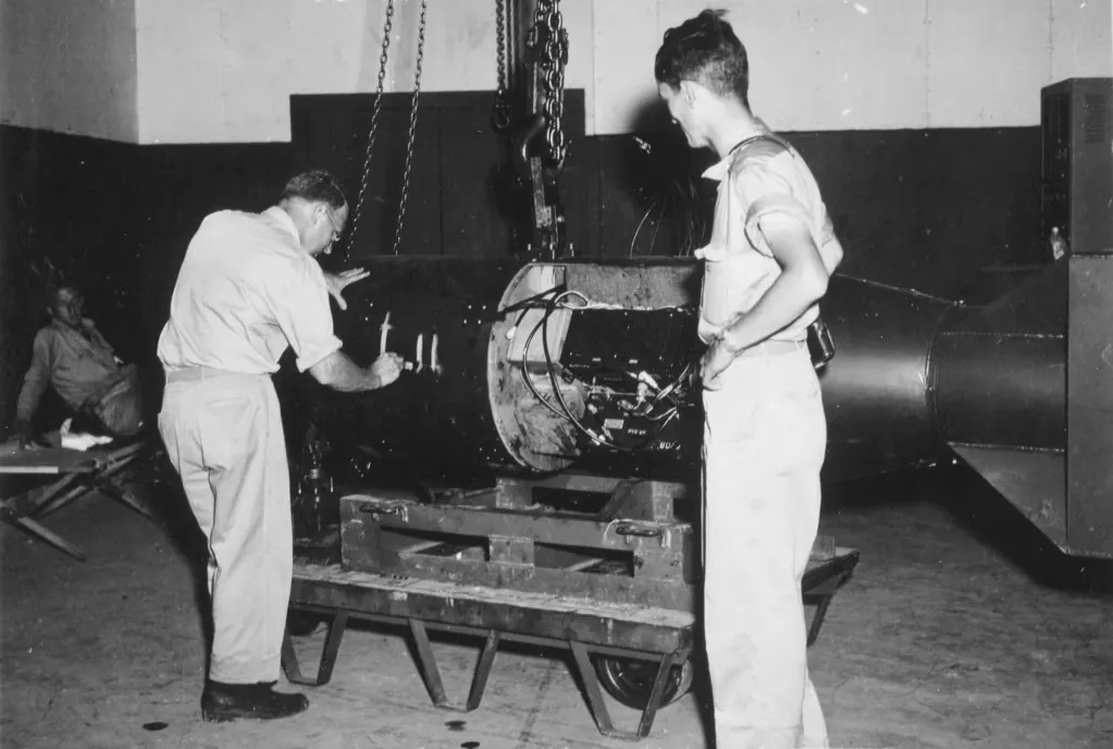
Its aircraft were a special type, modified Silverplate B-29s, and they flew from Runway Able, the northernmost strip, which kept them away from the main bomber groups. They used varied tail codes to avoid easy identification. The 509th also brought a party of 51 scientists, military and security staff from Los Alamos, known as Project Alberta, who were there to prepare the bombs. The pumpkin-bomb training flights and the arrival of the bombs themselves are covered in our posts on Hiroshima and on the Gun Site at Los Alamos. The point for this post is the geography: the unit lived inside a base of tens of thousands, ate and slept apart from it and told almost nobody what it was for.
Not everything connected with the group lies inside today’s landmark boundary. The three atomic bomb assembly buildings lie to its northwest, and so does the wing command area.
The pits
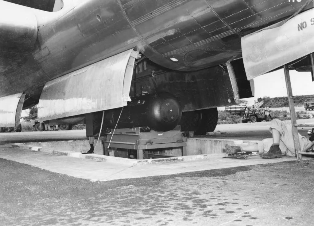
The weapons were too big to load under a B-29 in the ordinary way. The solution was two concrete-lined pits, built during the first 45 days of construction, beside a taxiway at the northwest corner of the northernmost runway. A B-29 was towed over the pit with its bomb-bay doors open, the bomb was brought up on a hydraulic mount, and a winch raised it into the aircraft’s belly.
Pit No. 1 was for the uranium bomb. The Enola Gay was loaded there on the night of 5 August, and Pit No. 2 was used to load the plutonium weapon into Bockscar. Both pits were filled in after the war, and for decades they were buried in dirt. One account says a coconut palm and a plumeria tree grew in the first, and that locals say the coconuts from that palm are misshapen. The pits were uncovered and reopened in 2004, on the 60th anniversary of the American capture of the island, with commemorative plaques, and are now protected under glazed panels. One of the plaques carries a line about the Japanese Emperor deciding, without his cabinet’s consent, to end the Pacific war. We mention it because it is a historical judgement written in stone at the spot, and a visitor should know that it reflects one view of a long-debated chain of decisions, covered in our Nagasaki post.
Left where it stood
The war ended in the same week as the last mission left, and the base emptied slowly. The 313th Wing moved to Clark Field in the Philippines on 1 February 1946, and the last American unit to leave, the 505th Bombardment Group, left on 30 June 1946. The base went on standby and was closed on 30 March 1947. The Navy disestablished its base on Tinian on 1 December 1946, and the island passed to the Trust Territory of the Pacific Islands in 1947.
Things were left behind. Vehicles, food, uniforms and even ice-cream makers stayed where they were, and local people used them. The B-29s that remained were cut up for scrap on the hardstands in the 1950s. A Japanese straggler, Murata Susumu, who had hidden since the battle, was found only in 1953. The airfield went to sleep. The jungle came back, mainly a tough thicket of tangantangan, which still obscures much of what lies beyond the runways.
The crushed coral surfaces turned out to last extraordinarily well. The National Park Service’s 2016 report describes the airfield surfaces as generally in good to excellent condition, with very little ground disturbance since 1945. Part of the Seabees’ later story is told by a quote. In 2003, a Navy Seabee battalion cleared Runway Able for a training exercise, and its command master chief, Bob Evans, said the Seabees had built those runways in the Second World War and had now worked on the same runways again. It is a good detail: sixty years on, the roads were still in good shape.
A landmark inside a military lease
North Field is recognised as part of a National Historic Landmark district, listed as Tinian Landing Beaches, Ushi Point Field and North Field, and known as the North Field Historic District. Dates differ across sources: one source says it was added to the National Register of Historic Places in 1982, another says the landmark designation came in 1985, and we have used both with those labels. The district covers about 2,500 acres inside a Military Lease Area of some 16,100 to 17,800 acres, depending on the source, which was created by a 1983 lease and takes up most of the northern two-thirds of the island.
The district’s features include the four runways, taxiways, service aprons and hardstands, the bomb-loading apron and pits, and the remnants of the 509th’s facilities. The Japanese layer survives as well: the service apron of Ushi Point, the air administration and operations buildings, air-raid shelters, pillboxes, ammunition and fuel bunkers and cisterns, plus concrete footings where Quonset huts, flak towers and radar towers stood. The two landing beaches, White 1 and White 2, are part of it, and a Japanese pillbox still stands on White 2. The period of significance is 1944 to 1945.
The runways wake up
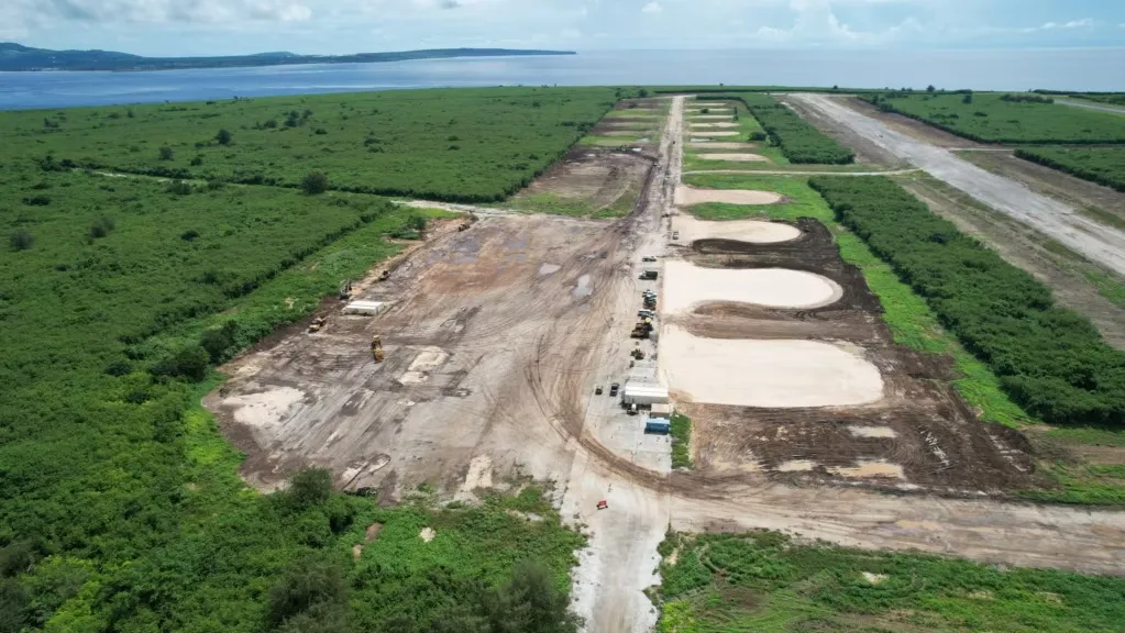
In the last twenty years the story has taken a turn that few would have predicted. The runways were cleared for exercises in 2003, and Runway Baker was partly refurbished by Marines in 2013, when a KC-130J landed on 5 December. Then, in late 2023, the US Air Force began clearing vegetation and restoring pavement at North Field as part of a divert airfield on Tinian, one of several dispersed bases meant to make it harder for any adversary to target American air power in the Pacific. Congress approved about $79 million that year, and in 2024 a contract worth $409 million was awarded to the Fluor Corporation. The work is expected to bring two of the four runways back into use by around 2027, and one account says more than 20 million square feet of pavement has been cleared, with Air Force RED HORSE engineering squadrons doing part of the work.
The same island that was the place of origin for the atomic bombs is once again being prepared as a forward base. Residents have voiced concern about rising tensions with China and about the island becoming a target. The historic questions are real, too. The National Park Service’s 2016 report on an earlier Navy and Marine training proposal found it would significantly diminish the district’s integrity, with particular concern over live-fire ranges, a proposed amphibious ramp at the Unai Chulu landing beach and vehicle courses running through the district. Access can also be limited during training, and upper Broadway can be closed.
Visiting
There are no formal tours, and we have not found opening hours or entrance fees. Reports agree on the route: head north on Broadway from San Jose or from Tinian International Airport, and look for signs to North Field. The road runs through forest, and the runways and the beaches can generally be viewed except when training is under way. The two pits are on the taxiway at the northwest corner of Runway Able, protected under glass panels with plaques beside them. Faded remnants of the wartime administration buildings and the old runways make up the rest of what there is to see.
Two practical points. First, the site is inside a military lease area, so closures happen, and with the construction work now going on it is worth checking before you travel. Second, the runways are largely accessible, and one source says that Able and Baker can be driven in an ordinary car, though weeds grow through the cracks. Take water. There are no facilities at the field itself.
A 2003 article records a memorial to the 107th Naval Construction Battalion on the road between the airport and North Field, which is a sign that the Seabees’ part of the story is remembered here as much as the airmen’s.
Conclusion
It is easy to treat North Field as the spot where two aircraft took off, and to leave it at that. The place is bigger and stranger than the missions. It was built over a sugar colony whose settlers were interned or killed or sent home, on an island whose original inhabitants had been almost wiped out two centuries earlier. It was made by about 13,000 Seabees in a few months, laid out like Manhattan and filled with tens of thousands of people, and for a while it launched a bomber every 15 seconds.
Then it was left, and what the forest did not take, the scrap dealers did. The runways, almost alone, survived, and now they are being brought back for the next war’s planning. The island’s story keeps repeating that pattern: a flat piece of ground, valuable to whoever holds the next distant power, and the people who lived there pushed aside each time. If you go, stand at the pits and then walk out onto Able, and look at how far it runs. It was built to carry more than a bomb. It was built to carry a war.
Did you know?
- Tinian lies only about 3.5 miles from Saipan and is only about 101 square kilometres in area.
- The Japanese began military construction on Tinian in 1939 using about 1,200 prisoners sent from Japan.
- The Marine landing on 24 July 1944 used two beaches only about 180 yards wide in total.
- The Battle of Tinian saw the first use of napalm in the Pacific war, though the results were inconclusive.
- Camp Churo held 11,465 civilians on 16 August 1945, with its own school, market and elections.
- Seabees built the first phase of North Field in about 45 days and nights.
- The Seabees laid out Tinian's roads like Manhattan, with a Broadway, a 42nd Street and a Central Park.
- At full effort the field could launch a B-29 about every 15 seconds.
- The 509th Composite Group had its own quarters, rations, payroll and medical care on Tinian.
- The two atomic bomb loading pits were filled in after the war and reopened in 2004.
- Vehicles, food and even ice-cream makers were left behind when the base closed.
- In 2024 the US Air Force awarded a $409 million contract to restore the former North Field.